
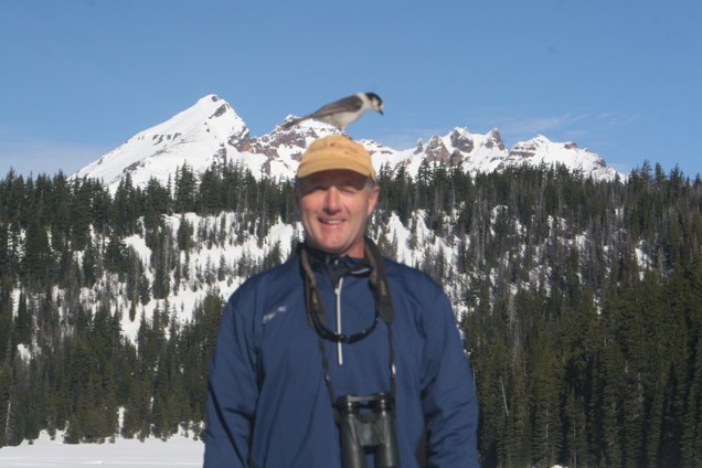
In southern Oregon, along the Cascade Crest between Klamath Falls and Medford, Oregon, is a great winter basecamp: Lake of the Woods Resort. Located just off Highway 140, the resort rests along the shoreline of the naturally occurring 1,150-acre Lake of the Woods. This destination provides winter enthusiasts such as snowshoers, Nordic skiers, snowmobilers, and ice fishers with spectacular views of nearby Mount McLoughlin (9,493ʹ), as well as endless opportunities to enjoy the snow.
For snowshoers, numerous trail options are located at different sno-parks in the area. Or, depending on the conditions, you might be able to snowshoe right out your cabin door. Since many trails are shared use, remember to use winter trail etiquette.
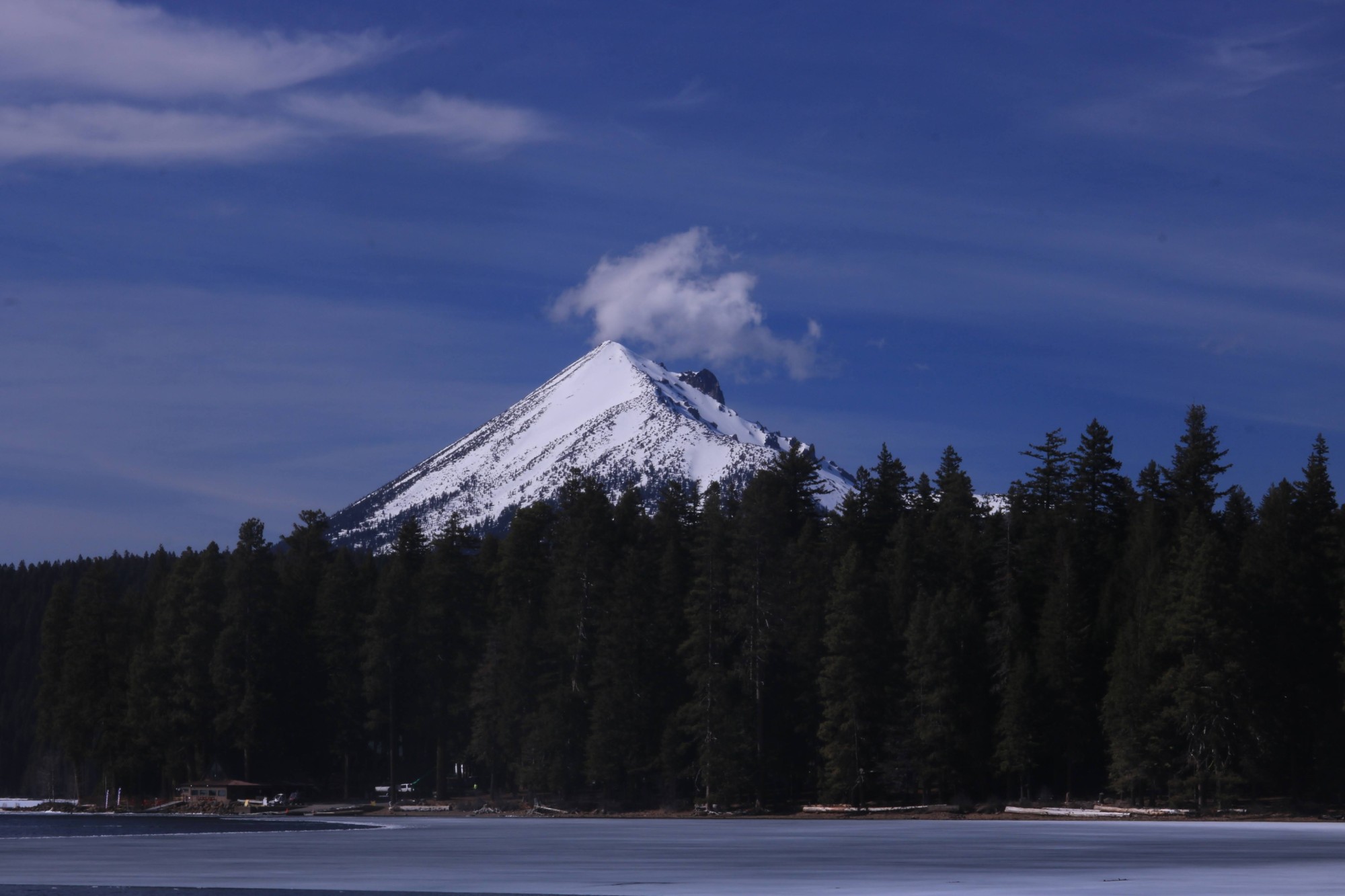
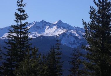
You’ll find gorgeous views while snowshoeing near Lake of the Woods, like this view of Mt. McLoughlin from the Sunset Campground Trail. Photo: Damian Fagan
Some of the links in this article may contain affiliate links. When you purchase using these links, part of the proceeds go to Snowshoe Mag. Additionally, as Amazon Associates, we earn from qualifying purchases. Please see our disclosure for more details.
Lake of the Woods
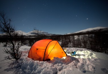
If the winter snow is deep, snowshoers can literally snowshoe right out their cabin door at Lake of the Woods Resort (4,600ʹ/1402m). In fact, there are two family-friendly trails accessible from the resort.
The Sunset Campground trail (1.0 mile/1.6 km, flat) weaves along the shoreline to the south and provides some exceptional views of Mount McLoughlin across the lake and of the private homes on the far side.
The Family Loop trail (2.0-mile/3.2 km loop, flat) begins near the Day Use Parking Area and loops through the woods to the northeast, paralleling the Dead Indian Memorial Road. Near the end of the loop, there is an informal trail that connects to the loop trail from Great Meadow Sno-Park, located along Highway 140, to extend this trip. The meadow offers great views of Brown Mountain (7,344ʹ /2238m), a small shield volcano with a cinder cone summit that last erupted roughly 2,000 years ago.
Lake of the Woods Resort, located approximately 36 miles from Klamath Falls, also has 35 cozy cabins for rent, which are equipped with kitchens, bathrooms, and, for some, a two-person jacuzzi. Several are pet-friendly, as well. The lodge serves delicious breakfast, lunch, and dinner meals, and the bar is open for liquid libations. The small general store and mercantile carry clothing, snacks, drinks, beer and wine, and gift items. Quite literally, you can stay and play at the resort without having to go anywhere.
Read More: Southern Oregon: Countless Snowshoeing and Apres Options
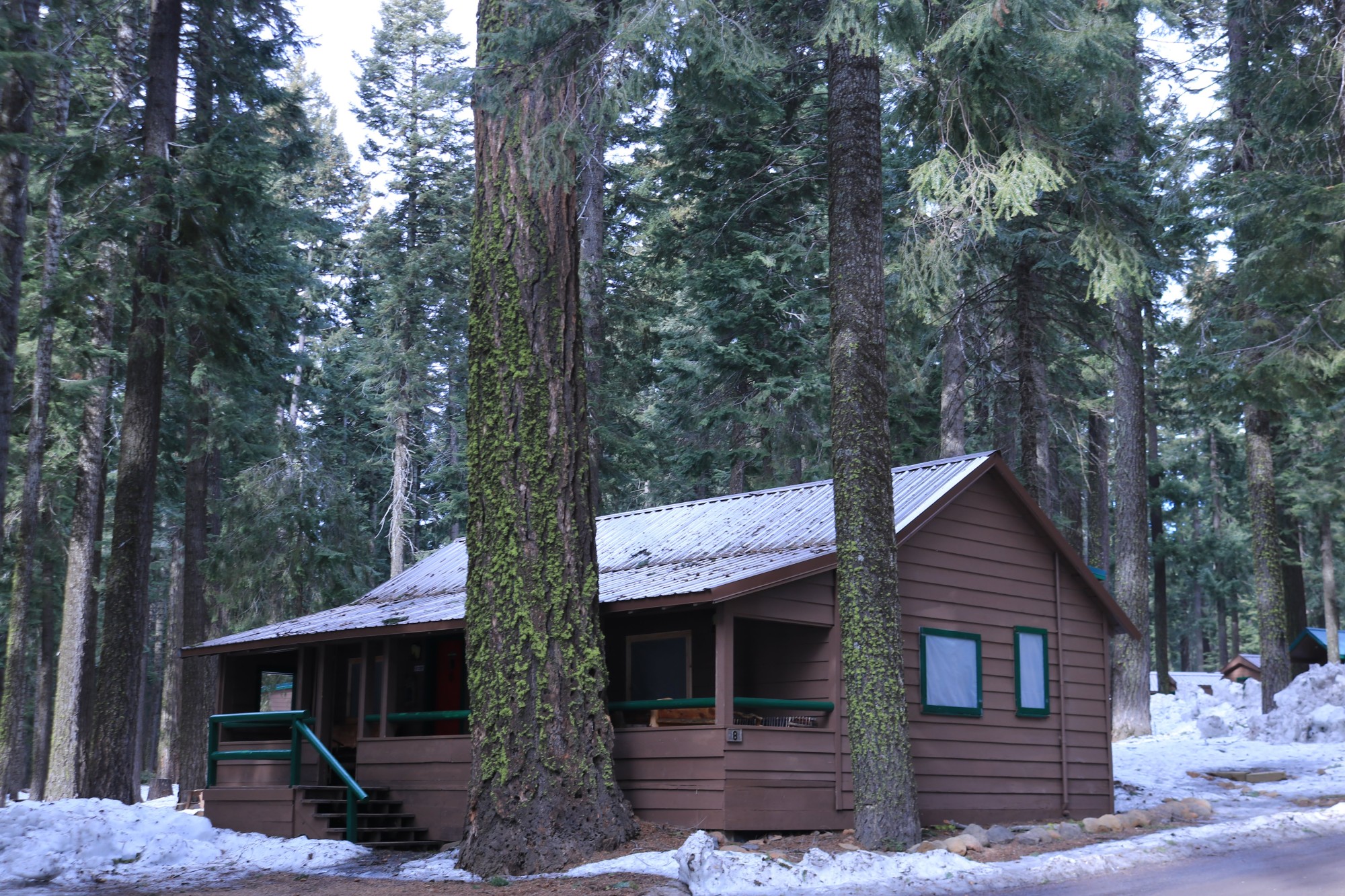
Depending on the snow level, it is possible to snowshoe right out your door at Lake of the Woods. Photo: Damian Fagan
Sno-Parks Along Highway 140
If you do want to explore more of the surrounding area near Lake of the Woods, there are several sno-parks along Highway 140 that provide access to miles of snowshoe and Nordic ski trails marked with blue diamonds. These sno-parks are in the Fremont-Winema National Forest in the southern Oregon Cascades.
The majority of sno-parks in southern Oregon require a sno-park permit from November 1 to April 30. A season’s pass is $25, but there is a daily pass ($4) or a 3-consecutive day pass ($9) option. Numerous vendors sell passes, or one can be purchased online from Oregon’s DMV2U website. California and Idaho sno-park permits are also accepted in Oregon.
Great Meadow Sno-Park
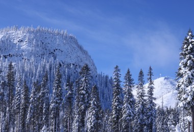
The Great Meadow Sno-Park (5,000ʹ /1524m) is a popular snowmobile spot. However, Nordic skiers and snowshoers can also explore this summer meadow which slumbers through winter under a blanket of snow. A 2.7-mile/4.3 km loop traverses along the outer edge of the meadow and has great views of nearby Brown Mountain and Greylock peaks, and is edged on two sides by paved roads. It is possible to also connect with the Family Loop Trail from the resort, but this connector is unmarked.
There is also a snowshoe trail between Great Meadow and Fish Lake to the west called the High Lakes Trail. Best done as a shuttle because it’s 9 miles/14.5 km between these points. Elevation gain is about 620ʹ /189m, and there are several options along the route to bail out to Highway 140 for a shuttle pick-up. The trail parallels Highway 140 but passes through some magnificent old-growth forests and interesting lava flows.
Read More: What To Bring When Snowshoeing: Top Accessories for the Day Hiker
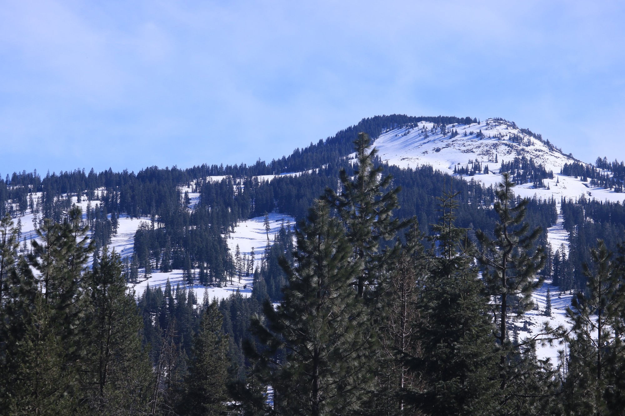
The loop traverses along the outer edge of the meadow, where you can see views of Brown Mountain. Photo: Damian Fagan
Fourmile Sno-Park
The Fourmile Sno-Park (5,000ʹ/1524m), located 2 miles/3.2 km west of the resort along Highway 140, is a small parking area. Here, multi-use trail enthusiasts start to follow Fourmile Lake Road to Fourmile Lake (named for the length of the lake).
Snowshoers can step away from the snowmobile traffic by shoeing the Billie Creek loop trail (5.6-mile/9 km loop), which parallels Fourmile Creek Road. A trail connector up to the Summit Shelter provides another destination for those looking for a quieter spot. The road is closed in winter, and it’s about 6 miles/9.6km to the lake.
Read More: Winter Trail Etiquette for Snowshoeing and Winter Hiking
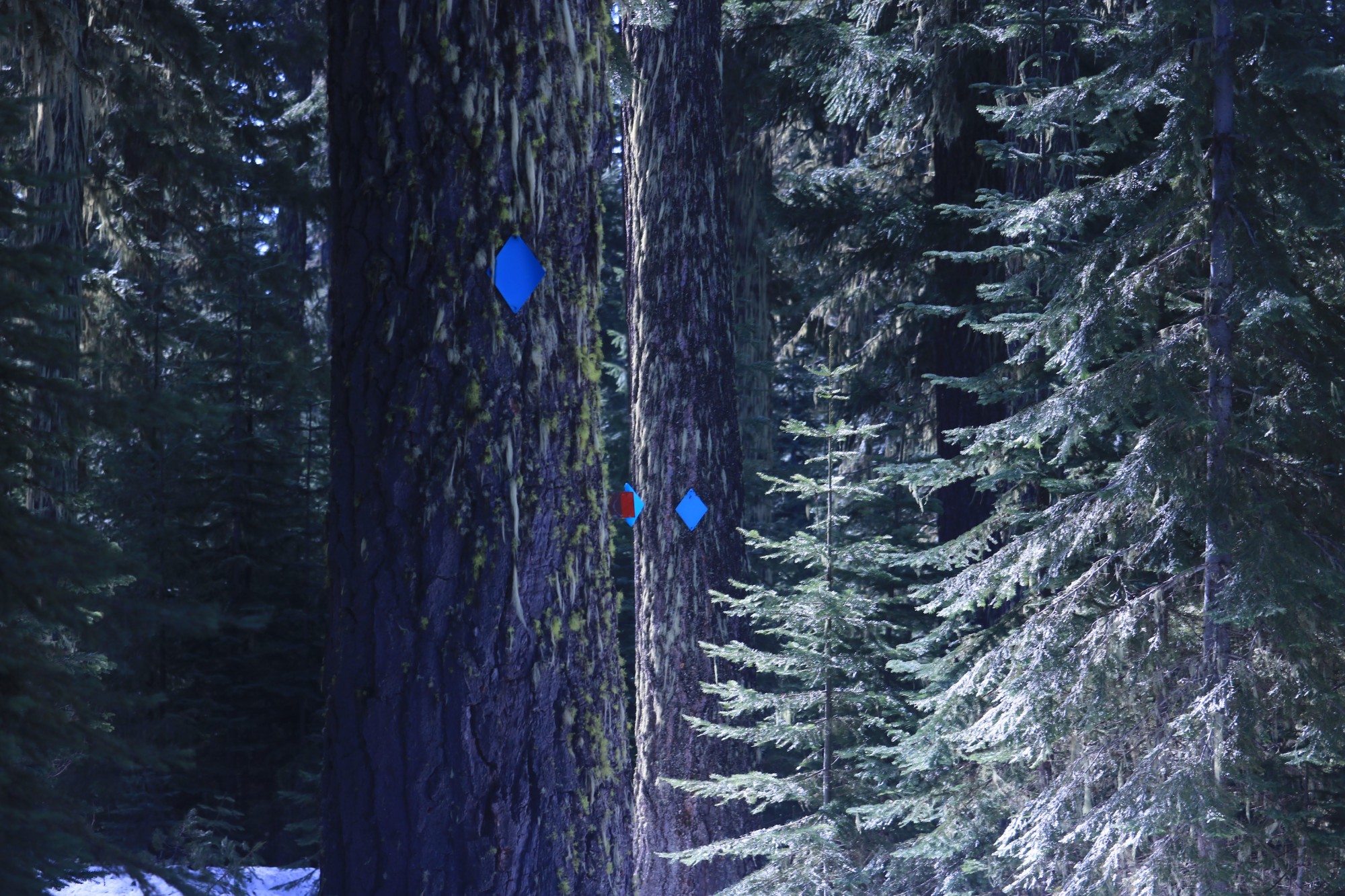
You’ll find trail markers on the old-growth coniferous forest of the Billie Creek Trail. Photo: Damian Fagan
South Rye Sno-Park
Continuing west along Highway 140, there are several informal plowed pullouts that connect to the South Rye Trail system. This Nordic ski trail parallels Highway 140 on the north side and is for skiers and snowshoers only. Dogs are not permitted on these trails.
From the South Rye Sno-Park (4,600ʹ/1402m), it is a 4.0-mile/6.4km snowshoe to the Summit Sno-Park or about 1.0 miles/3.2km to the Lund’s Link to access Fish Lake Resort. The quiet trail, except for some highway noise, explores a mixed coniferous forest and is another good trail to set up a vehicle shuttle.
Summit Sno-Park
The Summit Sno-Park sits at 5,000ʹ/1524m and is a great spot to start a snowshoeing adventure near Lake of the Woods. You’ll find looming peaks of Brown Mountain (7,311ʹ/2228m) to the south and Mount McLoughlin to the north.
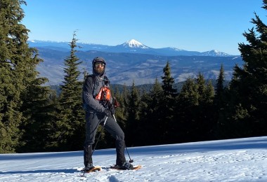
There is a winter snowshoe route up McLoughlin, but it’s unmarked and pretty exposed along the walk-up route. A better option for tackling McLoughlin is to wait until March or April. Then you can approach the peak from Mount McLoughlin Trailhead along Fourmile Creek Road. From there, the snowshoe/hike is about 10 miles/16km round-trip and gains roughly 4,000ʹ/1219m. The long ascent pays off with exceptional views from Mount Shasta to the rim of Crater Lake.
A Nordic trail system that is also open to snowshoers spreads out from the sno-park. Heading east on the Powerline Trail for a short distance, snowshoers then intersect a main trail known as the Lower Canal Trail. There are several options to split off of the Lower Canal Trail and snowshoe big or small loops through the forest. The Summit Shelter is a nice destination along the 6.3-mile (10km) loop from the sno-park.
Bringing a copy of the trail map is a good idea with all the trail intersections!
Read More: Snowshoeing Spectacular: Oregon’s Crater Lake National Park in Winter
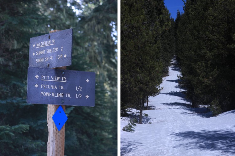
Choose from the Powerline Trail or Mount McLoughlin for your snowshoe outings at Summit Sno-Park. Photos: Damian Fagan
Fish Lake Sno-Park
Farther west of the Summit Sno-park is day-use parking near the Fish Lake Resort, called the Fish Lake Sno-Park (roughly 4,680ʹ/1426m). This park provides good access to the Lollipops Nordic Trails (also open to snowshoers).
The 6.8-mile/10.9 km Lollipop Loop is a relatively easy trail and offers some great views of McLoughlin and Brown Mountain. The Southern Oregon Chapter of the Oregon Nordic Club has a helpful trail map on its website.
Read More: 7 Beginner Snowshoes for Varied Terrain
Pederson Sno-Park
The oddly-named Dead Indian Memorial Road, which is the oldest crossing route of the southern Cascades, heads south from Lake of the Woods and loops towards Ashland, Oregon. The origin of the name is somewhat obscure. However, one possibility is the pioneers found some deceased Native Americans in a mountain meadow from unknown causes.
Along this road is the informal Pederson Sno-Park (5,200ʹ/1585m), with plowed parking but no restroom) in the Rogue River-Siskiyou National Forest. Crossing north over the road, there is a Nordic ski and snowshoe trail, which follows the Pacific Crest Trail to the South Brown Mountain Shelter (2.0 miles/3.2km).
Shortly before the trail split to the shelter, there is a wooden sign indicating the mileage to Canada or Mexico. Either way, it’s a long snowshoe. The old-growth forest here is impressive. Even in winter, a lucky snowshoer might hear the jungle-like call of a pileated woodpecker or listen to it hammering away on some snag.
The shelter was built in 1993 by Oregon Army National Guard volunteers. It’s a log cabin with a heavy-duty plastic drape for a door, a wood stove, and an elevated sleeping bench. The local snowmobile club and Southern Oregon Nordic Ski Clubs stock the shelter with emergency firewood. Camping in the shelter is allowed but not recommended. You may find an abundance of nocturnal rodents who might spend the night running across your sleeping bag.
Read More: Winter Camping Checklist: What To Bring on Your Trip
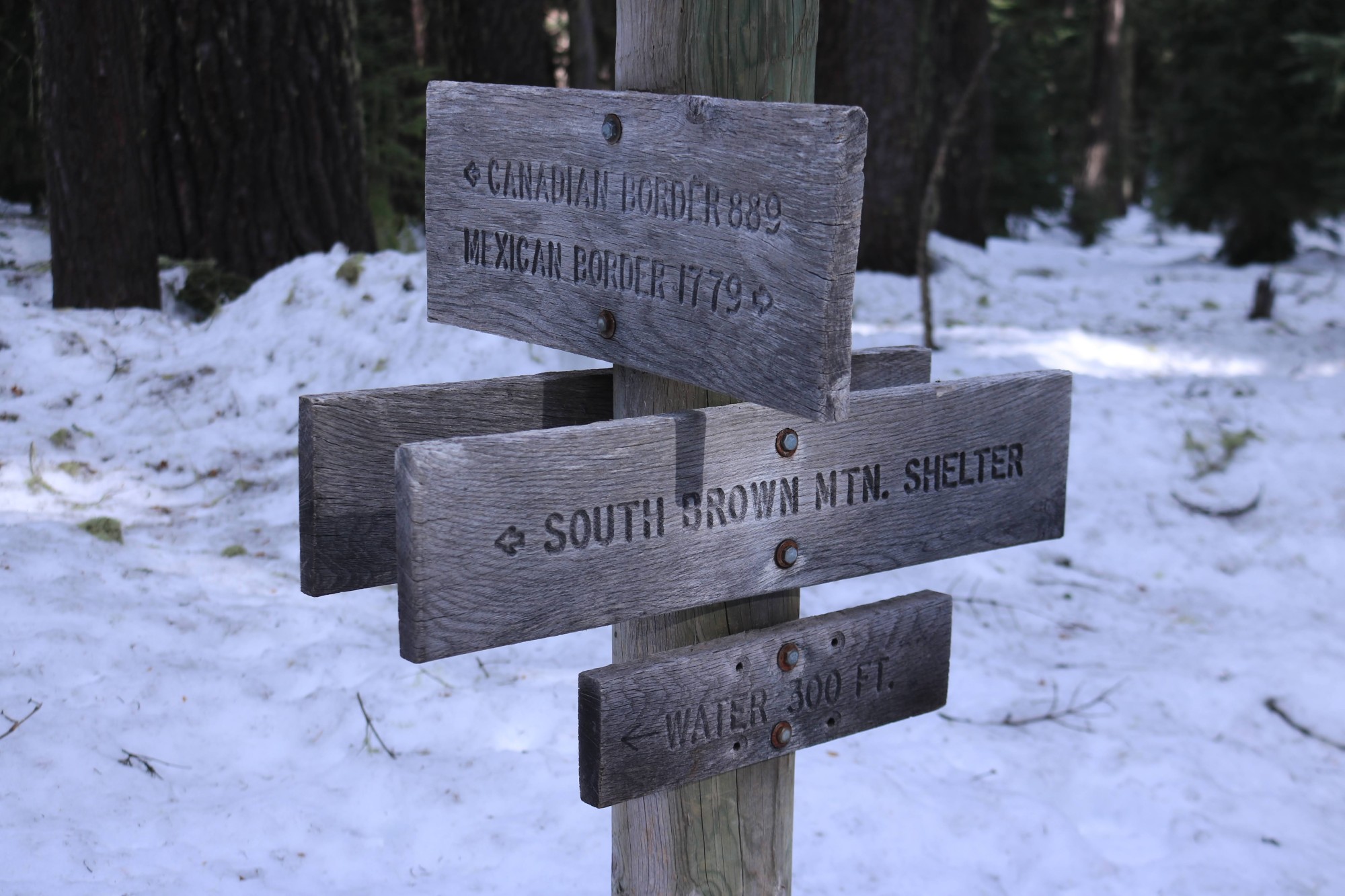
You’ll find signage to South Brown Mountain Shelter and to Canada and Mexico! Photo: Damian Fagan
Burton Butte
To the south of Pederson Sno-Park, lies Burton Butte (6,090ʹ/1856m). Though the Pacific Crest Trail is marked here for winter travel, there is an unmarked route to Burton Butte. The unmarked route partially follows the PCT. Then, it connects with some old logging roads and FR 3862 towards the southwest flank of the butte.
The pitch is gentler than the north side, and a good day’s destination is the large meadow on the butte’s southwest flank, which is spotted with trees (4.8 miles/7.7km round trip). The draw to summit the butte is always there, but trees may obscure the views.
Read More: Why You Should Use Snowshoes on Your Next Mountaineering Adventure
Après Snowshoe
Besides the Lake of the Woods Resort, there is another option for overnight accommodations for your snowshoeing adventures. The Fish Lake Resort, at Mile Marker 30, is under new management and now has 10 rustic cabins available in winter that can accommodate couples or small groups.
Equipped with kitchenettes or a full kitchen. The resort’s café is open in winter for breakfast and lunch and offers an extended lunch menu for dinner with Saturday night specials. A small general store stocks snacks and drinks. The resort is roughly 38 miles east of Medford, Oregon. Those wishing to stay closer to town can find lodging and dining in Medford, White City, or the Running Y Resort near Klamath Falls.
Read Next: Snowshoeing Oregon’s Santiam Pass Sno-Parks
Leave a Comment