Snowshoeing opportunities in the Eastern U.S. are no less abundant just because the mountains are shorter or the canyons are not as deep as in the American West. Our vistas and wilderness may not have the same epic quality as the Continental Divide, but they can relax the mind and soul. The mountains softly roll on into blue oblivion, cradling leafy gorges decorated with gorgeous white waterfalls.
Add snow and ice to the landscape, and the eastern mountains need not take a backseat to anything in the West. Here are four ways to snowshoe your way into this winter kingdom.
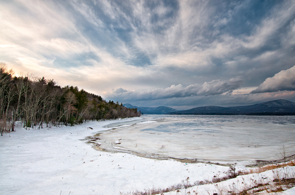
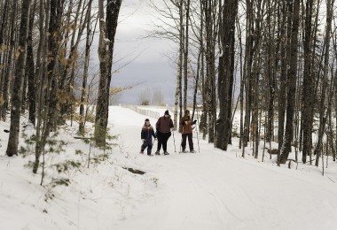
Eastern U.S. snowshoeing (like the Ashokan Reservoir here) need not take a backseat to that of the West and is just as beautiful! Photo: Reid Dalland via Shutterstock
Some of the links in this article may contain affiliate links. When you purchase using these links, part of the proceeds go to Snowshoe Mag. Additionally, as Amazon Associates, we earn from qualifying purchases. Please see our disclosure for more details.
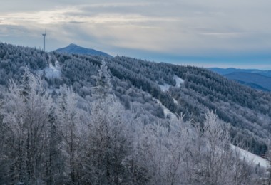
Stratton Mountain, Vermont
Why elbow for space on the mountain’s famous fire tower during the summer when you can have Stratton’s 3,940-foot (1200 m) summit to yourself in winter? Slip into the birch-dominated forest by way of the Appalachian Trail starting at Arlington-Stratton Road (you’ll need a four-wheel drive to travel the gravel road). Then, ascend for 3.5 steady miles (5.6 km) to the mountain’s peak and fire tower.
The 70 ft (21 m) tower, recently renovated, was constructed by the Civilian Conservation Corps in 1934. It offers up an around-the-world look at never-ending southern mountain ridges. After gawking at the view, you can either head back to your car or continue for another 2.6 miles (4.2 km) to the charming Stratton Pond. Camp on the shore or finish the 11-mile (17.7 km) loop via the Stratton Pond Trail and turn left on the Arlingon-Stratton Road back to your car.
The Stratton Mountain Trail is rated intermediate-advanced, so be prepared for your hike.
Read More: Stratton, Vermont: A Top Snowshoe Destination
West Rim Trail, Pennsylvania
Newbies to snowshoeing will appreciate the Eastern U.S.’s West Rim Trail. This trail’s mostly level pathway rides the western lip of northern Pennsylvania’s Pine Creek Gorge, dubbed by tourist marketers as the “Grand Canyon” of the Keystone State. It is indeed grand, dropping a thousand feet from the trail into the whitewater of Pine Creek. The walls are decorated with hemlocks, beech, and red oaks.
Day hikers will want to explore the portion of the West Rim Trail in Colton State Park (1 mi/1.6 km) near the northern Pennsylvania town of Wellsboro, while backpackers can attempt all 30 vista-filled miles of the north-south trail. This backpacking guide includes helpful information for hiking the full 30-mile (48 km) West Rim Trail.
Read More: Snowshoeing in Ricketts Glen State Park, PA
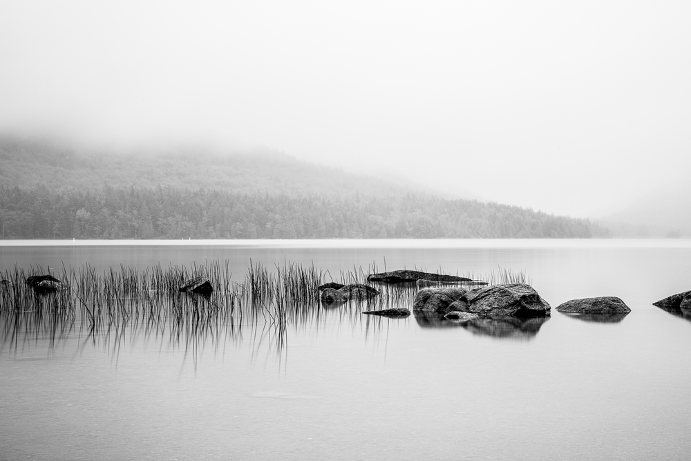
The 6-mile hike at Eagle Lake is a popular trail with a serene view. Photo: Yashaswita Bhoir via Shutterstock
Eagle Lake, Acadia National Park, Maine
Few places in the Eastern U.S. do snowshoeing, like Mount Desert Island in Acadia National Park. When snowfall covers the Yankee landscape, your camera will capture images of craggy mountains and the mirror-like waters of Eagle Lake.
Check it out along a pathway that circumnavigates the lake for a six-mile (9.6 km) loop popular with cross-country skiers and snowshoers. Start at the parking lot at Eagle Lake along Route 233. Enjoy the easygoing terrain as you stare at the mountains that ring the more than 400-acre lake, including Acadia’s famous Cadillac Mountain. Learn more information about winter hiking (including a map) at Acadia National Park.
Read More: Maine Snowshoe Trails: Acadia National Park Area
Ashokan High Point, New York
Deep in the Catskill range is the 3,100-foot (945 m) Ashokan High Point. There are ample snowshoeing opportunities through stands of hemlocks and mountain-laurel and memorable views of the surrounding snow-covered peaks. You’ll climb about 2,000 feet (610 m) over nine miles (14.5 km), but the views from the top will make the effort worthwhile.
Start from the trailhead near the parking lot on Watson Hollow Road, following the Kanape Creek into the forested valley and up the side of the mountain. At approximately 2.7 miles (4.3 km), bear right at a fork and ascend to the summit with views south and east. The trail loops around through open meadows with more mountain views before meeting up again with the path on which you started. Turn right and return to your car.
This article was first published on November 22, 2010, and was most recently updated on August 22, 2023.
Read Next: Snowshoeing Across the U.S: Midwest, East and West Conditions
Leave a Comment