October is the perfect time to begin the annual event of scouting out potential new snowshoe hikes in Southern Vermont and New Hampshire.
It is at this time that the leaves turn a brilliant orange, the blood sucking bugs go back into the dark cavern from which they emerged and the cool autumn breezes provide a welcome respite from the hot and muggy conditions that had proceeded them.
In my little corner of the earth as the days turn shorter, so do the opportunities to get outside and enjoy some of those epic fall scouting trips that can evolve into winter bliss.
With the unpredictable Northeast weather well entrenched in my mind, a cloudy, yet mild October day is all I needed to convince myself that now was the time to get out into the woods and create some mischief.
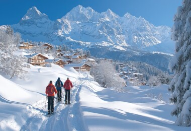
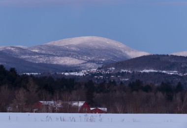
The target for this scouting expedition was Mount Monadnock, a well-known climb located in Jaffrey, New Hampshire that sees in excess of 125,000 people each year climb to its summit.
What makes Monadnock so popular, is its accessibility to hikers of all levels which, on its shortest trail, can take as little as 90 minutes to go from the New Hampshire National Forest parking lot to the top.
However, on this day, I am not looking for the road most traveled, I am looking for one of the many side trails that few who come to Monadnock think about and even fewer dare to try. I have heard from others that these fairly unused trails are where the best snowshoeing will be had and, if I have the stamina and equipment to scale one of the more treacherous ascents that lead to the top of the 3,165 foot summit, I will be rewarded for this labor with some of the most pristine snow enveloped views in all of New England.
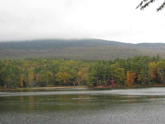
The trail starts harmlessly enough at Gilson Pond, a small body of water that has a quant campground perched around its eastern rim. This shallow body of water provides an excellent opportunity for visitors to be in immediate awe of this undeveloped and purely gorgeous piece of earth.

A look out over Gilson pond
As I hiked around the pond, which had little to no elevation change, I could not help but feel tempted to continue my walk around the entire pond loop trail. This trail would have brought me right back to my car in the matter of 30 minutes and would have provided me with an up-close look at all this little pond has to offer, certainly not a bad snowshoe route for those who are short on time.
However, I was on a different mission this day, one where I was going to forget about the warnings of high winds at the summit and the posted six-hour round trip which, if accurate, would put me back at my car just as the sun was setting.
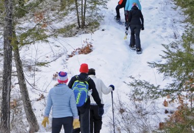
So, I left the Pond loop behind and began my first two-mile stretch, which only contained about 500 feet in elevation change. This stretch of trail, coupled with a trip around Gilson Pond, would make an excellent two-hour snowshoe in fresh conditions, one where you could be isolated from everything else, yet close enough to your destination to be in total control of your winter adventure.
It was at this two-mile mark where I had to make my first decision: Should I carry on with the mild elevation changes that included numerous switchbacks that so many have hiked before me? Or, in the alternate, should I branch out onto a different, more adventurous route, one that could either provide me with an amazing day of future snowshoeing or a sufficient warning that this trail was not to be messed with?
Naturally I chose the all-or-nothing route, which was innocently labeled the Spellman Trail, certainly not a name that would compel me to recheck my map, which I had conveniently left back in the glove box of my car.
What the map would have told me, was that for about 3,500 feet of the Spellman trail, the elevation would rise from about 1,900 feet to around 2,900 feet, certainly not the rolling terrain that would make up some of the best snowshoeing.
What made this stretch infinitely more difficult were the skies, which began to let loose with a steady rain, causing me to curse that damn hour-by-hour forecast I had looked at before I left my house that morning. This rain, coupled with the early morning showers that had fallen as I was driving to Jaffrey, turned the rocks I was ready to climb into an invariable death trap. I knew at this point that my little adventure could transform into something far more treacherous with just one misplaced step and, although my lack of medical insurance should have given me an ample reason to turn back, I let the stupid side of my brain take over. This decision lead me to use my four-point hiking stance, which is better known as scaling up the side of a damn rock face.
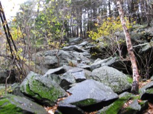
Yes, thats Spellman “trail”
However, it is my nature to look on the bright side of things, which, after an examination of my rations for the day, no longer included the moldy sandwich I had packed for lunch. Instead, I chose to focus on the fact that these conditions would be the closest simulation I would get to climbing these same rocks with my snowshoes on in the middle of winter.
Luckily, besides a few “oh s#%$!” where I temporarily lost my footing, the climb went off without a noteworthy incident. And, as I finally breathed a sigh of relief when I reached a flat patch at the 2,900-foot elevation mark, I was rewarded with the best view of the day, a grandiose view of miles-upon-miles of pristine New Hampshire landscape.
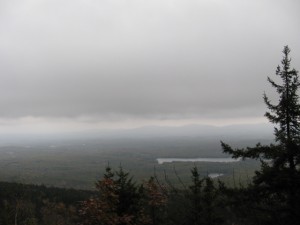
The view from 2,900 feet
Although on most trips, the final few hundred feet are the most exhilarating due to the fantastic view that customarily waits for them at the summit, my climb to the 3,000-foot mark was fairly anticlimactic and, in fact a little eerie. As I reached the top, the wind and rain began to kick in at full effect, leaving me in an almost mysterious haze, where I felt utterly alone.
Now granted, when the snow falls in place of the rain, there is always a little more magic in the air, however, it was at this point that I realized that in the middle of winter, it would be best to conduct this snowshoe with someone else. This would not only combat the sense of loneliness I felt, but would also give me another reason to cheer when we as a team finished the climb to the top of the mountain, which would be far from ordinary.
I made the best decision of the day to avoid traveling down Spellman on my way home, as the likelihood of me falling would have been almost assured. Instead, I elected to follow the Pumpelly Trail, which lead me to the Cascade Link, a spiral staircase that was intelligently designed to avoid many of the steep drops that plagued Spellman.
Although I was still punished for this slippery decent, which resulted in a few trips down the rocks on my backside, I was rewarded infinitely more with a trail that provided me with the most compelling snowshoe route to-date.
About half way down the mountain, Pumpelly intersects with the Cascade Link, the most direct route back to Gilson Pond. And, although the views became less dramatic each step I took, there were numerous rock ledges that gave me plenty of reasons to stop and pause.
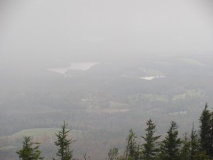
One of the many views on the decent
With this first scouting trip under my belt, it is now confirmed that the follow-up trip will include a Birchtoft-to-Cascade-to-Pumpelly ascent and decent, and an avoidance of Spellman, no matter how many delusional thoughts go through my head when electing to hike blindly to the top of this majestic mountain.
Leave a Comment