
Travel towards the southeastern corner of Oregon, and 30 miles south of Burns, you’ll discover the Malheur National Wildlife Refuge.
Founded in 1908, this stunning and vast habitat covers more than 187,000 acres of meadow with 120,000 acres of wetland. The refuge, in the lush Blitzen River Valley, is famous for its amazing diversity of wildlife and over the years has become a safe and protected haven for more than 300 different species of birds and over 50 species of mammals.
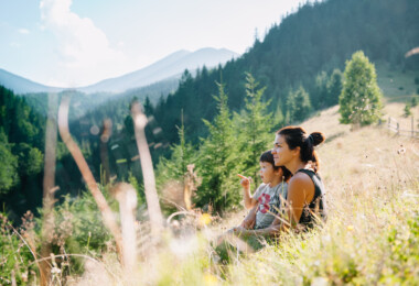
Numerous migrating birds visit the refuge seasonally to nest and breed. Among them, western snowy plovers, short-eared owls, and resident trumpeter swans offer superb viewing opportunities for countless birdwatchers and outdoor enthusiasts of all ages.
During the spring, waterfowl in their thousands descend on the wetlands along with tropical songbirds, all providing a riot of spectacular colour and sound. In summer, the refuge comes alive to the calls of nesting shorebirds, cranes, and ducks. The quieter winter season brings bald eagles, great horned owls, and black-billed magpies.
Malheur is a unique oasis in the surrounding Great Basin desert. It extends from Steens Mountain in the southeast to the edge of the Crooked River in the northwest. Its headquarters and small visitor centre on the southern side of Malheur Lake is a great place to start from. It houses maps and checklists as well as a list of rare sightings and viewing ‘hot spots’. The Memorial Museum opens to the public 24 hours a day and displays egg and nest samples and mounted specimens of almost all of the bird species to look out for. The visitor centre opens Monday to Thursday 8 a.m.-4 p.m. and Fridays 8 a.m.-3 p.m., closing at weekends and holidays.
 Running through the heart of the Malheur Refuge, the 30 mile long Central Patrol Road is undoubtedly your best route for bird and wildlife viewing. But winged and furred inhabitants are not the only visitor attractions. The refuge is a short way from a local petroglyph. A fascinating, historic structure called the ‘Round Barn’ that dates from the late 1800s. To get there, head east from the headquarters on Narrows-Princeton Road for nine miles. Here, the road turns to gravel and runs into Diamond Highway, a paved road that leads a further 12 miles south to the barn. Also not to be missed is ‘Diamond Craters’, a series of volcanic craters, domes and lava tubes. You’ll find them if you head six miles further south from the Round Barn on the Diamond Highway.
Steens Mountain
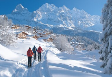
Once mistaken for a mountain chain and called the ‘Snowy Mountains’, Steens Mountain in Harney County, is the region’s highest. It borders the Malheur Refuge and its summit is well over 9,000ft above sea level. Steens Mountain is usually open from mid-July through to October. There are five gates at various elevations controlling access during adverse weather. The lower gates are usually open by May and the upper gates around mid-July.
 For the most spectacular views, take the Back Country Byway across Oregon’s high desert and up through this ruggedly beautiful peak. Several scenic stops along the byway provide superb views of Kiger Gorge and the vast expanse of the sagebrush-covered Alvord Desert. In almost every season of the year, wildflowers are in bloom and elegantly display their vibrant colours of purple, pink and yellow.
Even at this high altitude, there is a wide variety of wildlife to watch out for. On the lower slopes you’re likely to see pronghorn antelope while higher up, majestic bighorn sheep are often visible. Sightings of Rocky Mountain elk and Mule deer are more likely close to cover and water in the early morning or evening. Overhead, keep a look out for graceful golden eagles, falcons, and hawks as they circle on the lookout for prey.
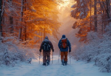
The Steens Mountain area has several trails for both horseback riding and hiking, and thousands of wide-open spaces for cross-country adventurers. The Mud and Ankle Creek is a 7-mile trek with a moderate rating and an elevation gain ranging from 100-2,500 feet. In spring and summer, there are many stream crossings that add to the adventure and the best times to hike are May to October.
Pike Creek follows an old jeep road for a mile and then becomes a walking trail for another mile before gradually petering out. More experienced hikers can pick up the trail further ahead where it eventually leads to a neat, well-established campsite. Keep a watch out for cougar, deer, and ever-elusive bighorn sheep on this 3-mile trail. Pike Creek is rated as difficult with an elevation gain from 300-3,000 feet. The best times to hike are from March to November.
Combining a stunningly serene mountain wilderness and 757 square miles of wildlife refuge, the diversity of Malheur and Steens Mountain complement each other perfectly. Attracting well in excess of 10,000 visitors annually, the region is both an outdoor and a naturalists paradise. Call Malheur Wildlife Refuge for further details on (541)-493-2612. The chance to get closer to nature is nearer than you think.

Leave a Comment