Oregon’s Santiam Pass is a unique pioneer-inspired crossing of the Cascade Mountains. This 4,817-foot (1,468 m) -high mountain pass connects Central Oregon with the Willamette Valley on the west side of the Cascade Mountains.
Long used by Native Americans as a seasonal hunting and plant collecting area, the pass is named in honor of the indigenous Kalapuyan people who historically lived along the Santiam River long before settlers entered the region. By the 1860s, emigrants who had followed the Oregon Trail (or other trails) and settled in the Oregon Territory began to use the pass. They were looking for routes to trail their livestock from the Willamette Valley east over the Cascades to grass-rich mountain meadows.
Hayrick Butte is one of the many sights on the trails near Santiam Pass. Photo: Damian Fagan
Andrew Wiley and other settlers are often credited with developing a route, often using trails the Native Americans created up the Santiam River and over the mountains. Eventually, this route became known as the Santiam Wagon Road. Wiley and others maintained and charged tolls to stockman trailing their animals over the mountains or emigrants heading west to the promised land.
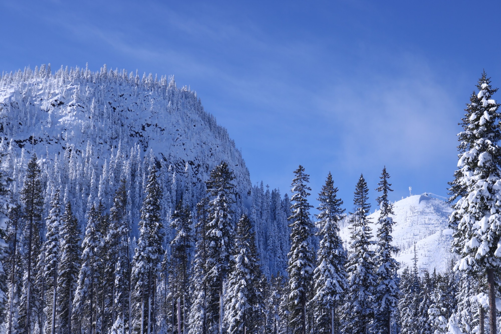
Today, Highway 20 crosses Santiam Pass near the Hoodoo Ski Resort, just west of the Pacific Crest Trail. Then, there are several splits that head towards Eugene (Highway 126), Albany (Highway 26), and Sweet Home (Highway 20). Several sno-parks provide access for snowshoers, Nordic skiers, and snowmobilers located along each of these highways. Together they form the Santiam Pass Winter Recreation Area.
Here are several of the sno-parks that offer snowshoe trails. Before heading out, make sure to check local road conditions, as some roads may be closed due to heavy snowfall.
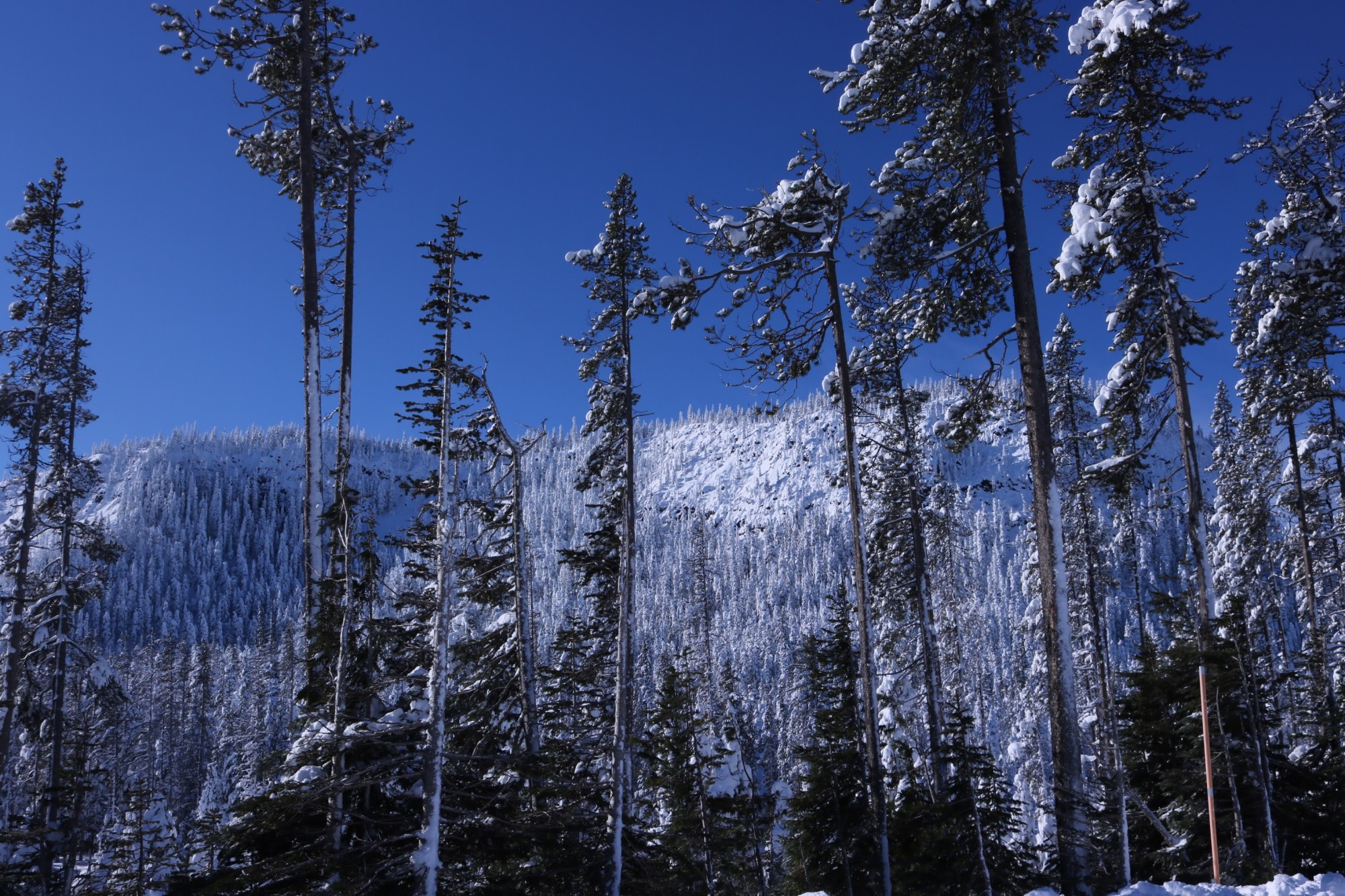
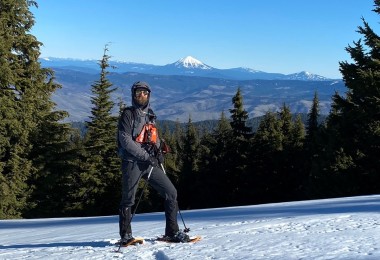
Several sno-parks offer snowshoe trails that lead to pretty spectacular views. Photo: Damian Fagan
Ray Benson Sno-Park
Located next to the Hoodoo Ski Area is the Ray Benson Sno-Park. Benson, a snowmobiler and owner of Benson’s Automatic Transmission Specialists in Salem, Oregon, advocated permitting snowmobiles in the backcountry. Eventually, statewide snowmobile groups joined forces and worked with the Oregon Department of Transportation to build winter parking areas to provide access for those venturing out in the snow, whether by gas- or human-powered means. Though Benson died in 1976, a year before the Oregon Sno-Park program kicked off, the Mount Jefferson Snowmobile Club urged the U.S. Forest Service to name the new sno-park to honor Benson.
With over 60 miles of shared-use Nordic and snowshoe trails, there are numerous opportunities to explore forests and vantage points at this location.
North Loop
Several main loops, such as the North Loop, cruise past incredible scenery. See silvery-white snags leftover from the 2003 B&B complex fire and mixed coniferous forests to the North Blowout Shelter, a warming hut with spectacular views of Black Butte, Mount Washington, and Three Fingered Jack. The North Loop offers several trail options for snowshoers to explore more of this sno-park, resulting in a 6-to-10-mile (9.6-to-16 km) loop.
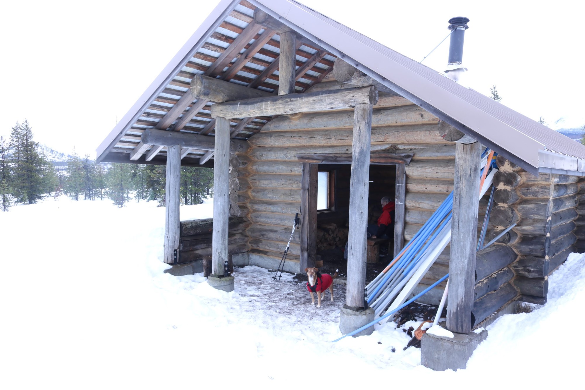
The Bradenburg Shelter is about halfway out on the South Loop, and perfect for a nice warm-up while you’re on the trail. Photo: Damian Fagan
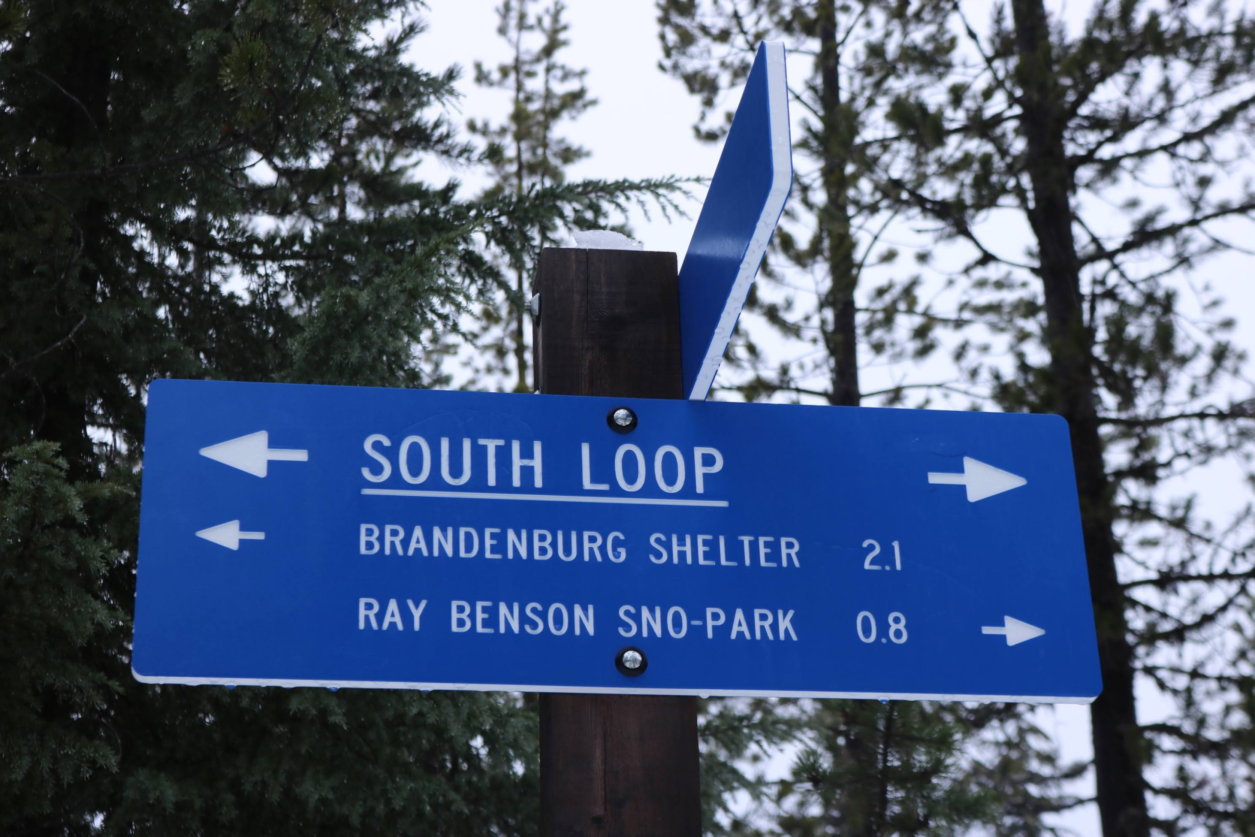
South Loop
South Loop, a 6.0-mile (9.6 km) adventure, follows the marked, shared-use trail to the Brandenburg Butte and Brandenburg Shelter, another warming shelter at the sno-park which the Oregon Nordic Club maintains. John Brandenburg was another one of the explorers, along with Wiley, who pioneered the wagon route up and over Santiam Pass.
Backcountry Trail
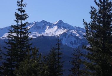
The towering monolith of Hayrick Butte and the pointed cap of Hoodoo Butte are also visible from multiple spots on the trails at Ray Benson. Hayrick Butte is unique because it is the remnant of a volcano that erupted beneath glaciers that blanketed the area during the last Ice Age. The molten lava melted a hole in the ice, acting as a mold. This feature is known geologically as a tuya, and a backcountry route enables snowshoers to circumvent this unique geologic feature.
Those tackling the unmarked, 3.6-mile (5.8 km) loop, starting at Ray Benson or the Hoodoo Ski Area, are often rewarded with outstanding views of nearby mountains. You’ll also have a view across the highway to Hogg Rock. This rock towers over the historical Santiam Pass Ski Lodge, undergoing a renovation project.
Read More: Oregon Winter Sports Resorts
See the towering monoliths of Hayrick Butte and the pointed cap of Hoodoo Butte from many trails at Ray Benson Sno-Park. Photo: Damian Fagan
Potato Hill/Little Nash Sno-Park
West of Santiam Pass along Highway 20, winter enthusiasts often overlook this smaller sno-park. Part of the reason may involve the 2003 B&B complex fire, which burned up much of the forest in this area. Another reason could be the location. The sno-park is located on a tight curve along the highway where crossing over on-coming traffic can be a real safety issue for westbound vehicles. Fortunately, a turnaround area is farther west on the road to return to this area.
Like many snow trails on the Willamette National Forest, these are shared-use trails between snowshoers and Nordic skiers. At Potato Hill, these trails utilize Forest Service roads closed in winter. Moreover, a trail connects to the Little Nash Sno-Park, where snowmobiles launch to access the general area. Both areas are open to dogs on leash in winter.

On the North Loop, you may be able to see a view of Three-Fingered Jack. Here, it’s peaking behind the clouds. Photo: Damian Fagan
Potato Hill Summit
The trail towards the summit of Potato Hill follows FR 830 or Jack Pine Road. A short side trip off this road provides an excellent view back down towards the highway. You may also see Lost Lake and Three Fingered Jack, a uniquely-shaped mountain. The name’s origin is lost to history but may be named after a trapper missing a couple of digits. From this viewpoint, the trail continues up Potato Hill and is roughly a 3.4-mile (5.5 km) round trip snowshoe to the summit. Once you reach the top, outstanding views of the surrounding peaks reward the effort.
Hashbrown Loop
Another route follows the Hashbrown Loop, which eventually connects to Jack Pine Road. The total round trip mileage is about 7.4 miles (12 km) with around 1,400 feet (426 m) of elevation gain. Again, the effort is rewarded with great views of the surrounding peaks.
Read More: Oregon Sno-Parks: History and Snowshoe Opportunities Near Mt. Bachelor
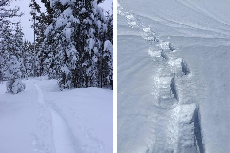
Left: The trail to Potato Hill is a 3.4-mile (5.5 km) picturesque round-trip. Right: Make your own tracks to the Lava Lake Viewpoint. Photos: Damian Fagan
Lava Lake Sno-Park
Located near the intersection of highways 126 and 20, the Lava Lake Sno-Park offers several relatively easy loops for snowshoers or Nordic skiers. Note that some portions of these loops intersect with snowmobile trails.
Overlook of Lava Lake
One loop, about 2.2-miles (3.5 km), heads east through old-growth forests to an overlook of Lava Lake – a snow-covered meadow in winter and seasonal lake in summer.
Loop to Fish Lake Remount Depot
A 2.4-mile (3.8 km) loop trail goes from the sno-park, crosses the highway to the south, and connects with the historic Santiam Wagon Road. Following the road through old-growth forests leads to the Fish Lake Remount Depot, a historical landmark. This landmark was first a way station for travelers on the Santiam Wagon Road, then a Forest Service ranger outpost from the early 1900s. Today, two of the cabins built in 1924 are available to rent during the winter months through Recreation.gov.
Read More: Winter Trail Etiquette for Snowshoeing and Hiking
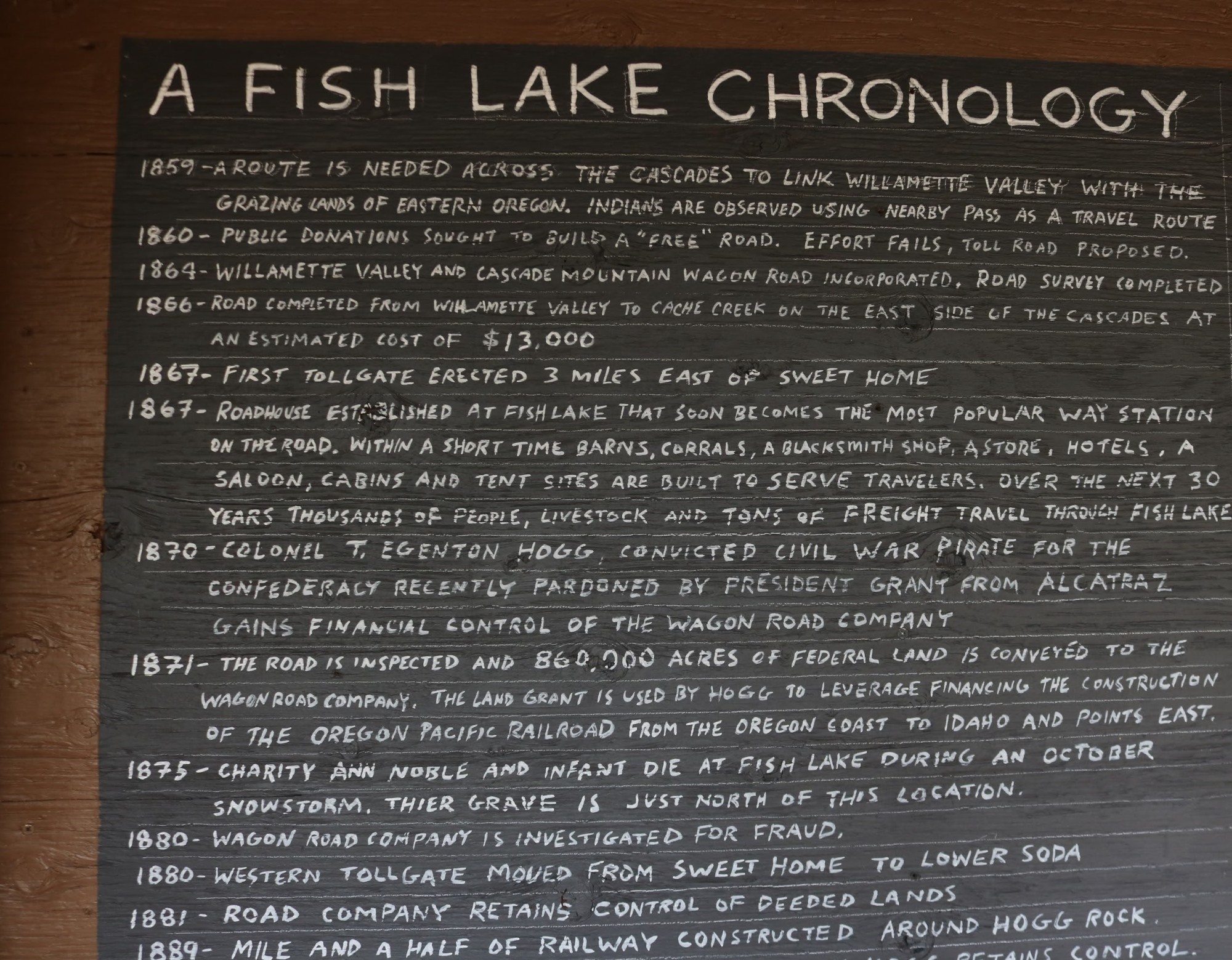
So much history (and this is only a part) at Fish Lake Remount. Photo: Damian Fagan
Other Sno-Parks
Though these are several of the sno-parks in the Santiam Pass region, others include Maxwell Butte, Big Springs, and IkeNick. The latter was named after Issac Nickerson, a young man who perished one winter long ago and wasn’t discovered missing until spring.
The great mountain views, quiet old-growth forests, varied terrain, minimal weekday traffic, and scattered warming shelters are just some of the reasons snowshoers explore this winter wonderland.
Après Ski
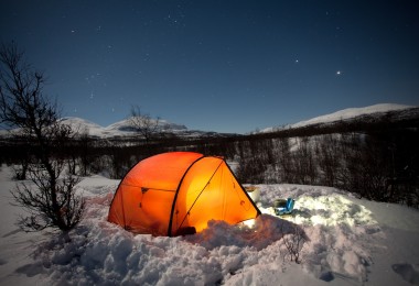
Santiam Pass is the dividing line between the Deschutes and Willamette National Forests. In winter, the only overnight accommodations near the pass are the rental cabins at the Fish Lake Remount Depot.
West of Santiam Pass
About 30 miles (48 km) west of Santiam Pass, down Highway 126 towards McKenzie Bridge, is a great overnight location: Belknap Hot Springs. There are rooms in the lodge or cabins to rent (RV hookups, too) and an outdoor heated pool to soak in along the banks of the McKenzie River.
Dining options are limited due to the town’s small size. However, the McKenzie Station Pub is a restaurant, bar, and coffee shop specializing in burgers and sandwiches located right on Highway 126. Across the street from the pub is the McKenzie General Store which offers lunch and dinner Thursday thru Sunday and local products for your grocery needs.
Read More: Central Oregon: A Beer Lover’s Paradise
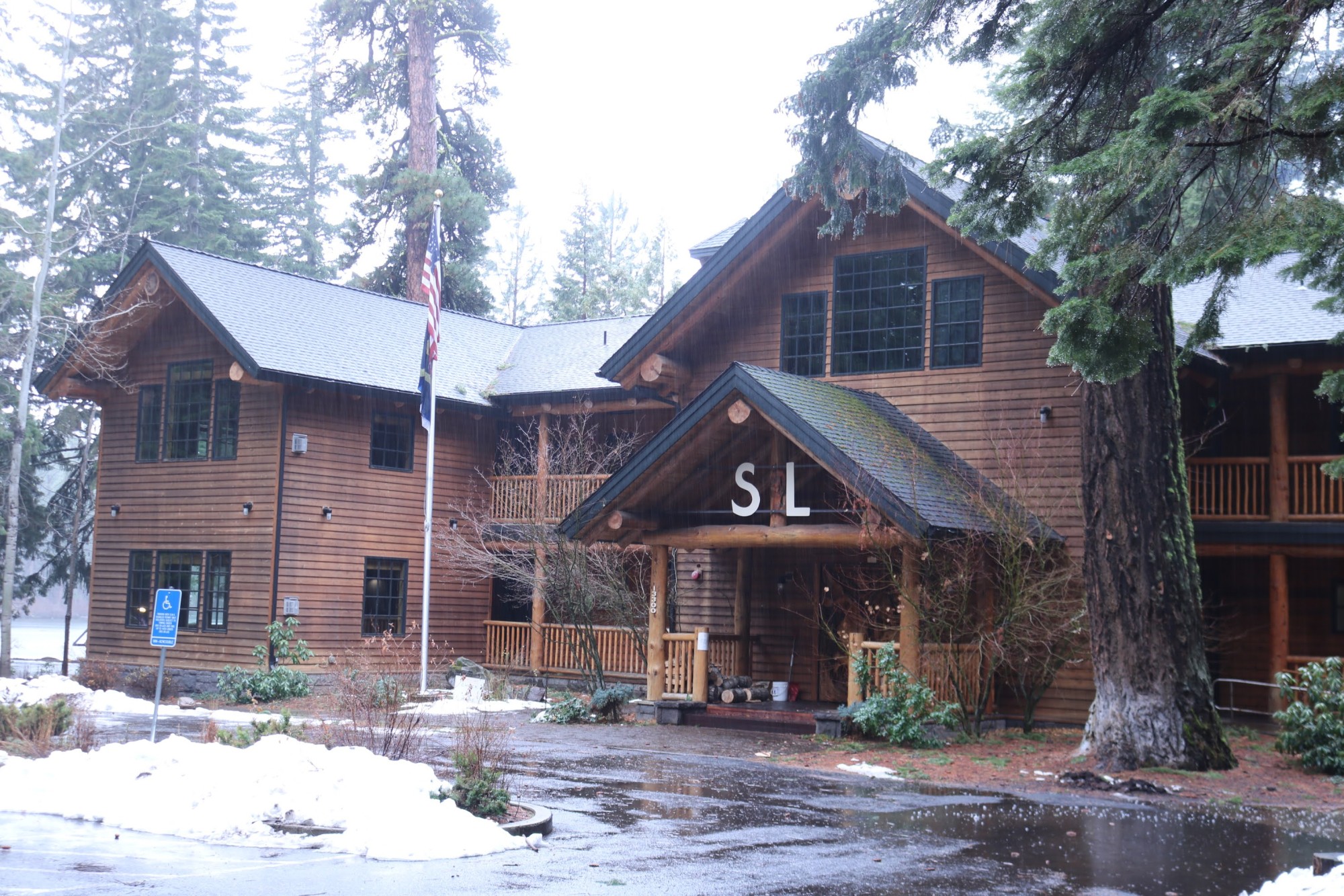
About 9 miles east of Santiam Pass is The Suttle Lodge. Located along beautiful Suttle Lake, this lodge offers overnight rooms and cabins in the winter. Photo: Damian Fagan
East of Santiam Pass
On the east side, about 9 miles (15.5 km) from Santiam Pass, is The Suttle Lodge. Located along beautiful Suttle Lake, this lodge offers overnight rooms and cabins in the winter. The Skip Bar serves specialty cocktails, lunch, and dinner, as well as a delicious weekend Brunch. In addition, the Lodge offers a ski/lodging package with the Hoodoo Ski Area and partners with Wanderlust Tours. On the tour, naturalist guides lead a nighttime snowshoe on Saturday nights in January and February. Then, be treated to a warming-fire amphitheater carved into a snowy flank of Hayrick Butte.
Sisters, Oregon is another 12 miles (19 km) east of Suttle Lake along Highway 20 and has more restaurants and overnight accommodations, if needed.
By the Numbers
Ray Benson Sno-Park elevation: 4,790 feet (1,460 m)
Santiam Pass Elevation: 4,816 feet (1,468 m)
Potato Hill Sno-Park elevation: 4,100 feet (1,250 m)
Lava Lake Sno-Park elevation: 3,480 feet (1,060 m)
Oregon Sno-Park permits required November 1 through April 30; annual $25, 3-day pass $9.
(Sno-park permits from California and Idaho acceptable)
What are some of your favorite sno-parks near Santiam Pass? Which of the parks above do you want to snowshoe? Please share your thoughts with us in the comments below.
Leave a Comment