Fall is the prime season for hiking Central Oregon’s trails. All the snow has finally melted. The start of school thins out the crowds. The month of October is fee-free. And, there’s a bittersweet quality to the trek knowing the snow will fly soon and shut down hiking for another year.
Here are a couple of moderate uphill hikes with breathtaking views as the summit reward and a third easy one that offers scenic river views.
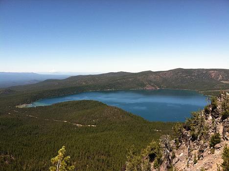
PAULINA PEAK:
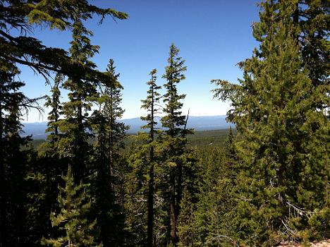
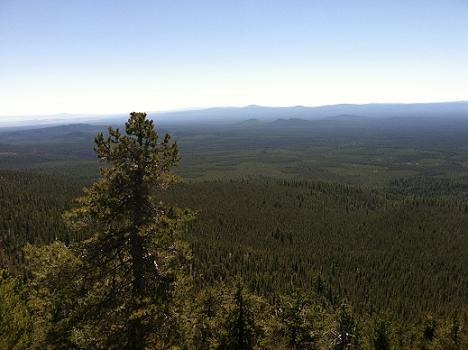
The trail and road go to the top of the Newberry Caldera, formed when the volcano collapsed on itself. At 8,000 feet, the views from the summit include the Cascade Range from Mt. Adams in Washington to Mount Shasta in California and sweeping vistas across the High Desert
We hiked the road, which was still closed in July and scheduled to open in August. It’s paved for about a mile, up to the parking area, and then gravel to the top. The trailhead is opposite the parking area. While the trail can be dusty, the road is most enjoyable without cars.
The elevation gain is 1,566 feet and the distance is about 4 miles roundtrip by the road, more like 5 miles if you start at the gate when the road is closed.
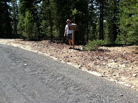
On the road up, you will pass a 7,000-foot elevation sign. This is a good spot to stop and look back at Paulina Lake, one of the deepest lakes in the region. The lake formed in the collapsed caldera of Newberry Volcano.
From the summit you can also glimpse the smaller lake to the east of Paulina, East Lake. Another bonus—restrooms at the top.
Allow about four hours for the entire roundtrip.
There are numerous other hiking possibilities in this area. Paulina Lake is an 8.6-mile loop. Paulina Creek Falls is an easy 1.6-mile roundtrip walk. Big Obsidian Flow, a gigantic flow of black glass, is .8 mile. For the hard-core hikers and mountain bikers there is the rim trail, which goes around the whole caldera at 21 miles.
The Paulina Peak trail is closed to bikes and horses, but the road is open to both. Bring mosquito spray and plenty of water.
From Bend, drive 24 miles south on Highway 97, then 13 miles east on County Road 21 past the fee booth, and then ¾ mile south on Forest Road 500 to the parking area on the right.
County Road 21 is closed at 10-mile Gate (named for its distance from Hwy. 97) after October 31. Paulina Lake Lodge is open year-round and accessible by snowshoe, cross country skies or snowmobiles from the 10-mile Gate sno-park.
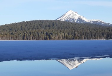
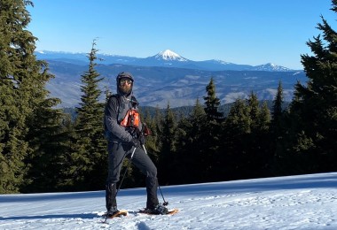
TUMALO MOUNTAIN:
Another moderate uphill hike, this one has an elevation gain of 1,200 feet. I would say it’s on the harder side of moderate because it’s truly uphill all the way.
The trailhead is very near the Mt. Bachelor ski area. From Bend, take the Cascade Lakes Highway and one-fourth mile past the first ski area exit, turn right into the Dutchman Flat sno-park.
The view at the top extends east all the way to Bend across the Sunriver meadows. Mt. Bachelor is next-door to the south and beyond that the Three Sisters Range.
Like Mt. Bachelor, Tumalo Mountain is a cinder cone, formed by volcanoes. During the winter, Tumalo Mountain is a favorite of backcountry skiers and boarders who hike up and ride down the eastern flank.
We hiked it in mid-June and there was still snow at the top, but we passed hikers who were dressed for summer with shorts and flip-flops.
As you begin the hike, you’re traveling up through forests of hemlock, fir and lupine. Occasional openings in the trees allow for clear views of Mt. Bachelor. Trees thin out about halfway up and the path gets steeper, switching back across red cinders close to the top.
The summit is 7,776 feet with few trees or vegetation. The most significant sign of past activity is the concrete foundation of a long gone lookout tower.
Snowshoers use this trail often in the winter. A sno-park pass is required November 1 to April 30. The day rate is $4, three-day is $9 and annual is $25.
FALL RIVER:
The Fall River, on the way up to Cascade mountain hiking, is a pristine spring-fed river, a favorite for fly fishing. The hike along the river is an easy, level one —5.6 miles roundtrip—and open year-round except for heavy snowstorms. Elevation of the Fall River is 4,300 feet.
The Fall River is south of Bend. Take Highway 97 about 16 miles, turn west on Vandevert Road (the next exit after Sunriver). At the stop sign, turn left onto South Century Drive. It turns to the right after one mile; continue for about 10 miles to the Fall River Campground entrance. Parking is available for day use.
The trailhead starts at a post behind campsite No. 8, near the turnaround. The trail meanders through lodge pole pines and bitterbrush.
The picturesque footbridge over the Fall River has several short trails near it and they’re all dead-ends. Still, it’s worth standing on the footbridge and looking down into the clear, cold water, so clear you can see any fish that might be swimming by.
The trail ends at a small little ripple of rapids at the end of public lands. It’s a perfect fall hike and the changing colors of the surrounding brush and foliage reflected in the water is an artist’s dream.
The trail is dusty. Mosquito spray recommended.
The actual springs at the source of the river can be seen by driving .7 miles east of the campground on South Century and parking at the guard station on the left. Walk around the building’s yard to find the springs.
The fish hatchery is also worth a visit. It’s about 3 miles west of the campground on South Century Drive.
For a map of the Newberry Caldera and all the hiking trails around it, visit http://bit.ly/q14m4C.