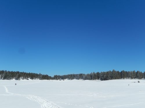
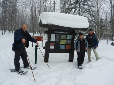
Last week at Winter Trails Day at Echo Lake, I tried on a pair of Tubbs and headed across the frozen surface. Although not quite what I would call an expert, I was the experienced one in my party of two as my companion was Jimmy, a profound thinking and esoteric hippie from Pennsylvania.
He had never snowshoed before, and I, being Yoda to his Luke, offered up what pearls I could on what has become an engrossing hobby for me. I babbled on about the features of the shoes we were testing, trying to temper any perceived condescension on my part with the knowledge that I am still most certainly a novice. All that went out the window as we began a hard climb toward Mt. Evans and I had my hands on my hips sucking wind.
Jimmy leads a purer lifestyle than me, weighs about 100 pounds less, and hopped around like a spindly wood sprite while I regretted the cigarettes I’d smoked the night before. During one of our intermittent oxygen breaks, our conversation deepened and we began to discuss survival in the wilderness. What would we do if we were lost, miles away from civilization and off the trail? Would we know how to use a compass? Would we even have one? Not that we were in any immediate danger being two of hundreds who participated in Winter Trails Day, but good questions to ask as the snow fluttered down about us.
The following week I took the first steps toward answering these questions and attended the Maps, Compasses, and Orienteering class at REI (offered every Friday at the REI Denver Flagship store at 1 p.m.). Our professor for the day was a gentleman from the USGS who began the mini-seminar by passing out compasses. Our first task was to simply face North using the compass. Easy, right? Not when the group dynamic is at play, and your brain is working overtime to keep you from looking foolish. We spread out in the camping merchandise section with our heads bowed, taking tiny steps and spinning like obedient drones staring at our palms.
I glanced up to see that my classmates were all facing me, thankfully still looking down, and I adjusted accordingly. We then learned that “North” in Colorado is different (as it is in every geographic location) in that you have to adjust for declination, a scientific concept outside the scope of “Marcus the Intern”. Suffice to say it means that true North is really about eleven degrees Northeast of the “N” on the compass.
We discussed the procedure for navigation in a given direction, noting that you do not simply stare at your compass and mindlessly march, but identify a unique landmark in that direction, calibrate, and reevaluate your position when you arrive. We broke out the laminated maps, did some role-playing, and discussed the 10 essentials (the minimum things you must have with you when embarking on a remote hike). I then went cross-eyed as our instructor attempted a crash course in triangulation, leaving scrawled dry erase arrows all over the map and me to wipe the drool from my chin.
I can’t say I left the class ready for extreme adventure in the Antarctic. I may go again just to make sure I’ve got the basics down. But I can proudly proclaim that as far as orienteering and map reading goes, I know shinola from that other stuff. The truly Zen moment occurred when the instructor half jokingly said “the best way to avoid getting lost is to stay found”.
Now that I can understand.