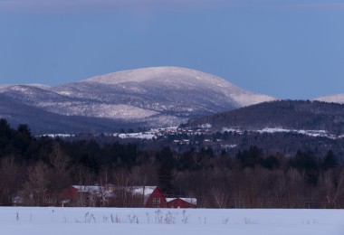
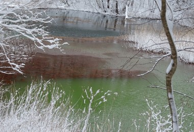
The Chaîne des Aravis, or Aravis range, is a range of mountains in the Haute-Savoie department of France close to the Swiss border and Geneva. The mountains are sub-alpine and part of a larger group known as the French Prealps, which run from Geneva towards Albertville (the site of the 1992 Winter Olympics). The high point of the range is the Pointe Percée, at 2752m.
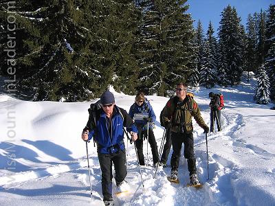
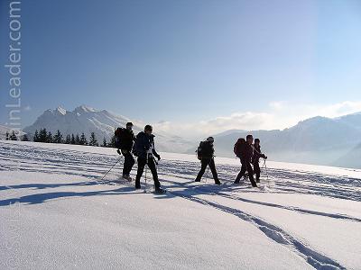
Within this area, there’s a well-known haunt of French snowshoers and Nordic skiers – away from the crowds of the larger ski stations. There’s some fairly extensive alpine skiing in the areas of Le Grand Bornard and La Clusaz. The area is also well-known for Nordic skiing and has produced several French champions, including Winter Olympic medalists Roddy Darragon and Sylvie Becaert.
The area, like so much of France, is notorious for local cheeses such as “Chevrotin des Aravis.” This type of cheese is made from goat milk. A full block of cheese, with a diameter of only 8cm, requires about six liters of milk and takes about 6 weeks to mature. However, the most famous is Reblochon, a soft cheese made from the unpasteurized milk of local alpine cattle.
Reblochon is an old word coming from the root “reblocher,” which means “to pinch a cow’s udder again.” This is the practice of holding back some of the milk from the first milking. This was an old trick of the local tenant farmers, dating back to when the landlord would tax them on the amount of milk their herds produced. Once the landlord had safely departed, the canny farmers would finish milking the herd. This second supply of milk would be much richer and it was used to make the cheese we call Reblochon today.
Reblochon is important to us at the end of a long day in the mountains; it’s the staple ingredient of a local dish known as Tartiflette. This is a baked dish of potatoes, Reblochon, cream and lardons (small pieces of pork fat). Tartiflette is probably best enjoyed with a local Savoie white wine, such as Apremont. This wine is made from the Jacquère grape, which produces crisp and fruity wines ideal with melted cheese dishes.
Where to Go: St. Jean de Sixt
An easy itinerary, taking a few hours, can be started from the village of St. Jean de Sixt. This is on the road between La Clusaz and Le Grand Bornard, only a short distance between the two locations. It’s well worth taking a little time to look around the small village of St. Jean de Sixt, which dates back to the middle ages. The word “Sixt” comes from an older word “scis.” This means “stones,” referencing some of the old quarries nearby. The “St. Jean” was added later, in honour of the patron Saint of the parish.
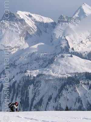
From St. Jean you can snowshoe up through the hamlet of Granges, before climbing up through the forests towards Danay D’en Haut (around 1470m). Then, snowshoe onto the small summit of Tête Du Danay (around 1700m). Although it’s a small peak, the Tête Du Danay sits squarely in the middle of the valley and gives great views of the La Clusaz, Le Grand Bornand and the local mountains.
Time: Around 600m of ascent to the peak, taking around two hours and 30 minutes for the ascent. Return by the same route. Total time is around four hours.
Getting There and Where to Stay
The two main local centres are Le Grand Bornard and La Clusaz. These are both ski stations, have a large number of hotels, and self-catering apartments. It’s also possible to stay in the larger towns of Chamonix or Annecy and make day trips to the Aravis.
From Geneva, the city or the airport, it’s a short trip in the car to the Aravis area.
Guidebooks and Maps
The Cicercone guide “Snowshoeing – Mt Blanc – Western Alps – France Switzerland Italy” (ISBN 9781852843762) contains routes around the region. However, it has no routes in the immediate vicinity of La Clusaz or Le Grand Bornand.
The Institut Géographique National (IGN) have maps of the area, the most useful is the 1cm: 250m sheet number “3430ET.” Electronic versions of the maps are available, either on DVD or for use on Garmin GPS receivers.
The regional tourism website has a number of snowshoeing routes with descriptions in French.
Links
Cicerone Guidebook: http://www.cicerone.co.uk/product/detail.cfm/book/376
Institut Géographique National (IGN), maps: http://www.ign.fr/
Regional tourism website: http://www.tourisme-haute-savoie.com/Topoguides/Topos-guides-Raquettes/
Le Grand Bornand Tourist Office: http://www.legrandbornand.com/
La Clusaz Tourist Office: http://www.laclusaz.com/